
Open Space Sandbox
A public urban design platform empowering communities to shape their local spaces

MY ROLE
Product Designer
Co-founder
TIMELINE
2 months
TEAM
1 PM
1 Developer
WHAT IS OPEN SPACE SANDBOX?
Open Space Sandbox is a software startup bringing urban design into the 21st century. The OSS interface seamlessly aligns practitioner design, community design, and revenue analysis to ensure a highly-collaborative and iterative design strategy.
CONTEXT
Urban planning is evolving as cities increasingly recognize the value of designing spaces that reflect diverse community needs. With growing populations and evolving public expectations, there is a push toward creating inclusive spaces that foster connection and utility.
However, traditional design processes remain resource-intensive and rely heavily on expert-led decision-making, often limiting the role of community voices.
Problem Discovery
The urban planning process today is plagued by unnecessary complexity, what should be a linear process often diverges into redundant directions or incorporates superfluous elements. This system limits transparency and makes collaboration among key players—urban planners, architects, and community specialists—both tedious and inefficient. Consequently, public input becomes difficult to gather and integrate meaningfully, leading to designs that lack true community alignment.

How can we make urban design collaborative, transparent, and community-centered?
Ideation & Research
Landscape Audit
I began with an audit of industry-standard GIS services currently on the market (ArcGIS, Delve, Ginkgo, Hoodmaps) to better understand the tools users in this industry were used to and best practices for mapping platforms. Among these tools, there was a focus on craft and high customization and a lack of collaboration and/or community-driven features.

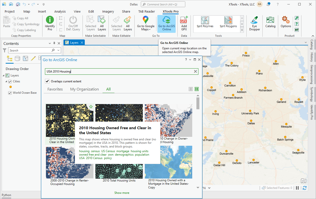
ArcGIS


Hoodmaps
User Interviews
To better understand the industry, I met with urban planners, which provided a nuanced view of the current design process, key handoff points, and various roles involved. These conversations revealed common pain points:
Underserved
Public
Underutilized
Spaces
Costly Design
Processes
Limited Revenue
Capabilities
MVP Roadmap
Based on these findings, the OSS team and I created a prioritized list of features for the MVP, including data analytics, a community design tool, and alignment scoring. I developed a wireframe, gathered feedback from both the product development team and potential users, and then refined the UX flows accordingly.
Solution
The platform offers a comprehensive, inclusive approach to urban design that benefits communities and planners alike by synthesizing the practitioner design and community consultation processes, simplifying planners workflows and amplifying community voices.
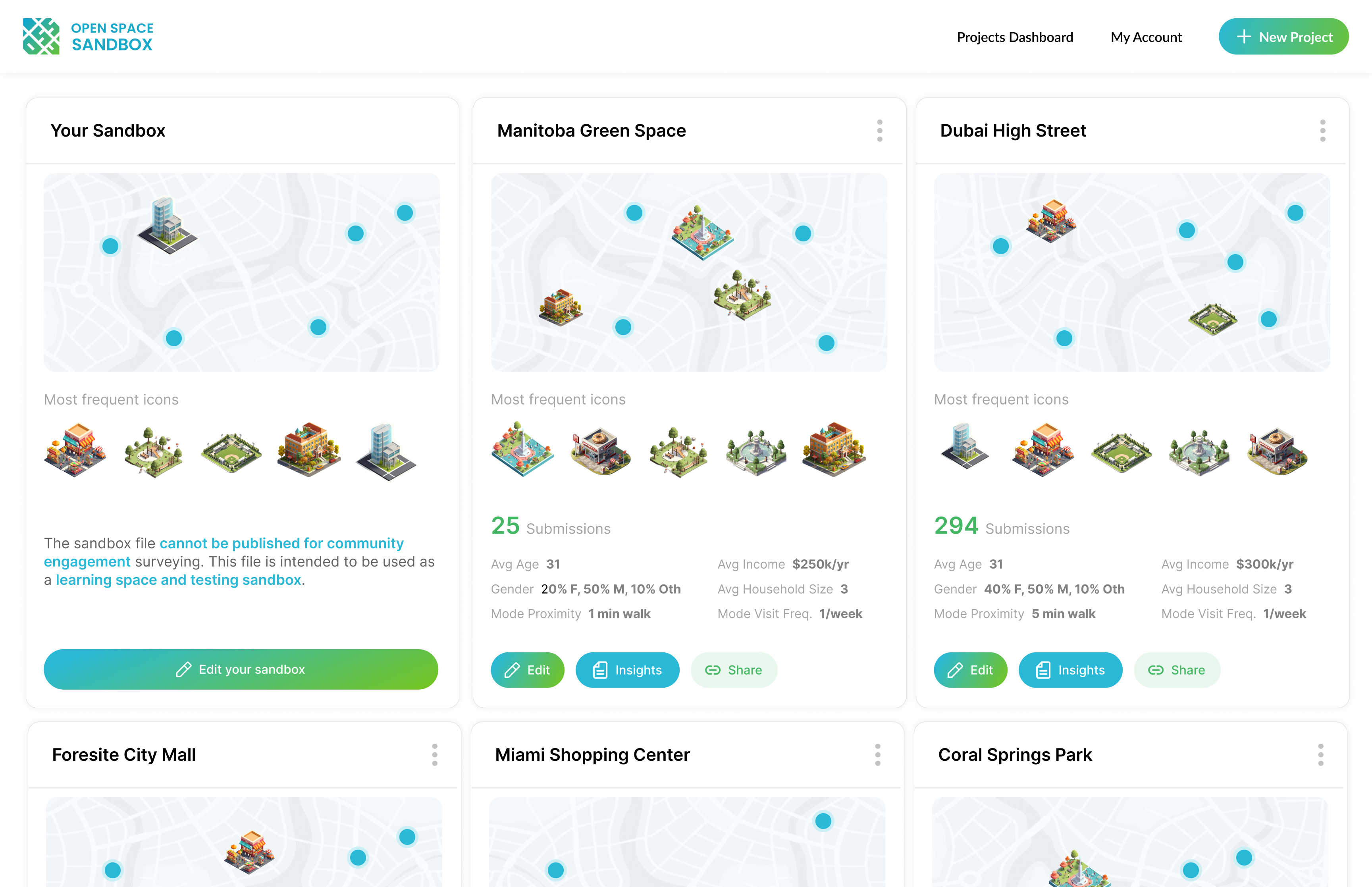
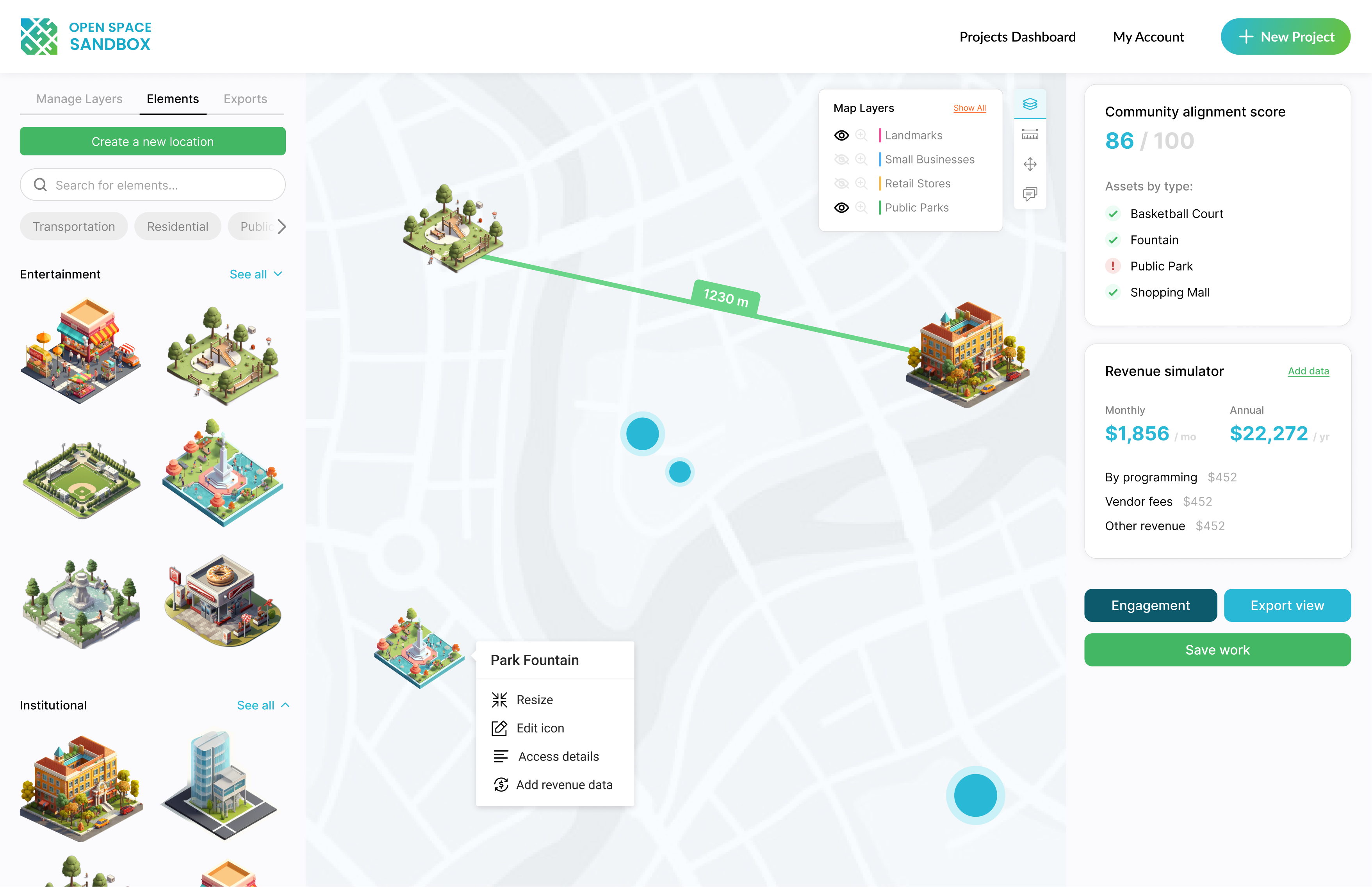
Practitioner Tool
The OSS admin interface seamlessly aligns practitioner design, community design feedback, and revenue analysis to ensure a highly-collaborative and iterative design strategy—ultimately synthesizing the design and consultation processes for practitioners. For urban planners, this new workflow dramatically reduces project timelines, costs, and redundancies.

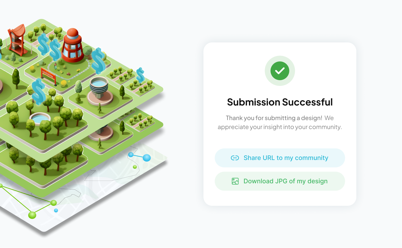
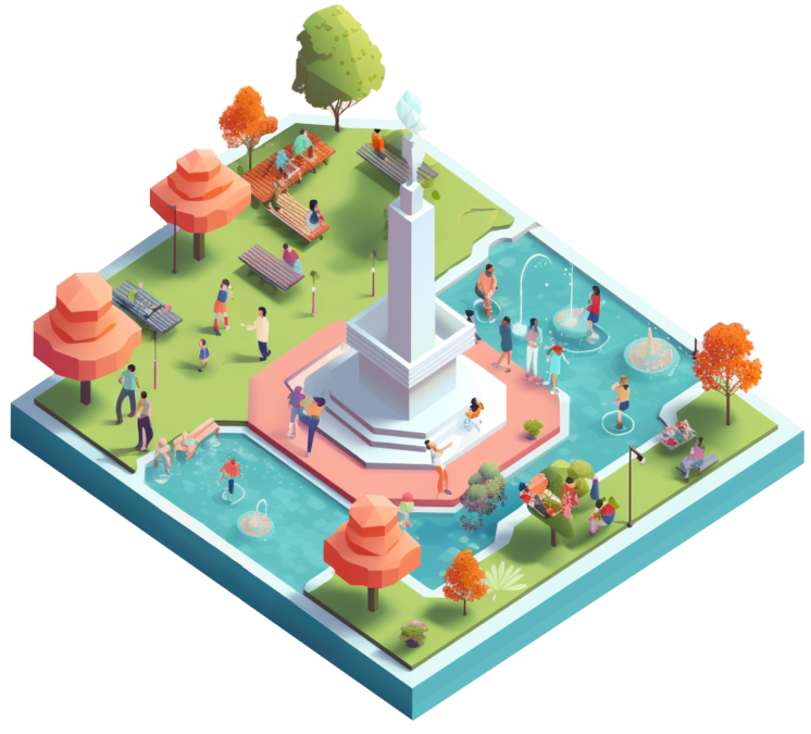
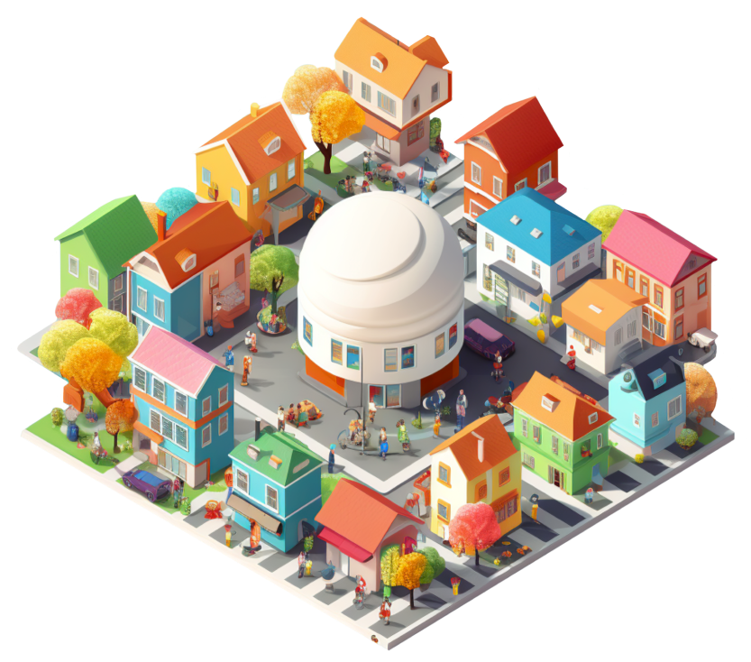
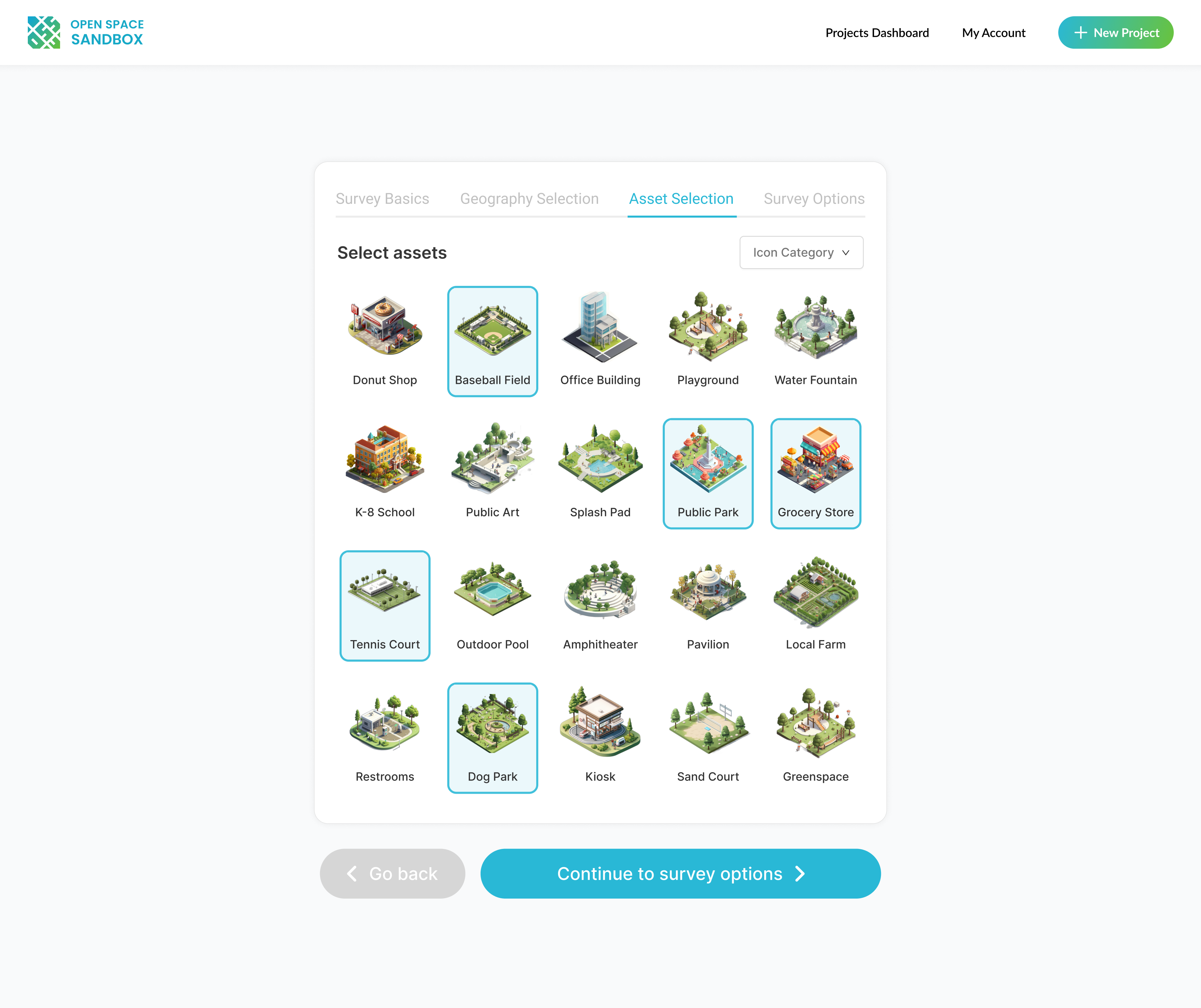
Gamified Public Community Tool
For residents, OSS's live-design link provides a real opportunity to influence the spaces that shape their daily lives by allowing them to submit proposals for new spaces in their area. The interface leverages a gamified design style to engage community members as they design their ideal public space plan(s).


Ideation & Research
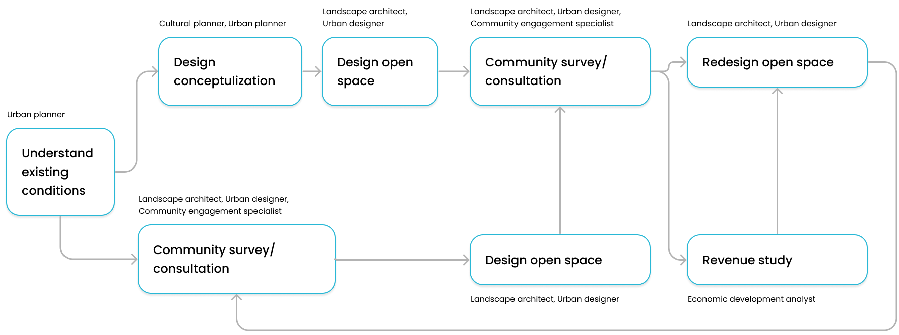
The New Open Space Process
Initial Design and Data
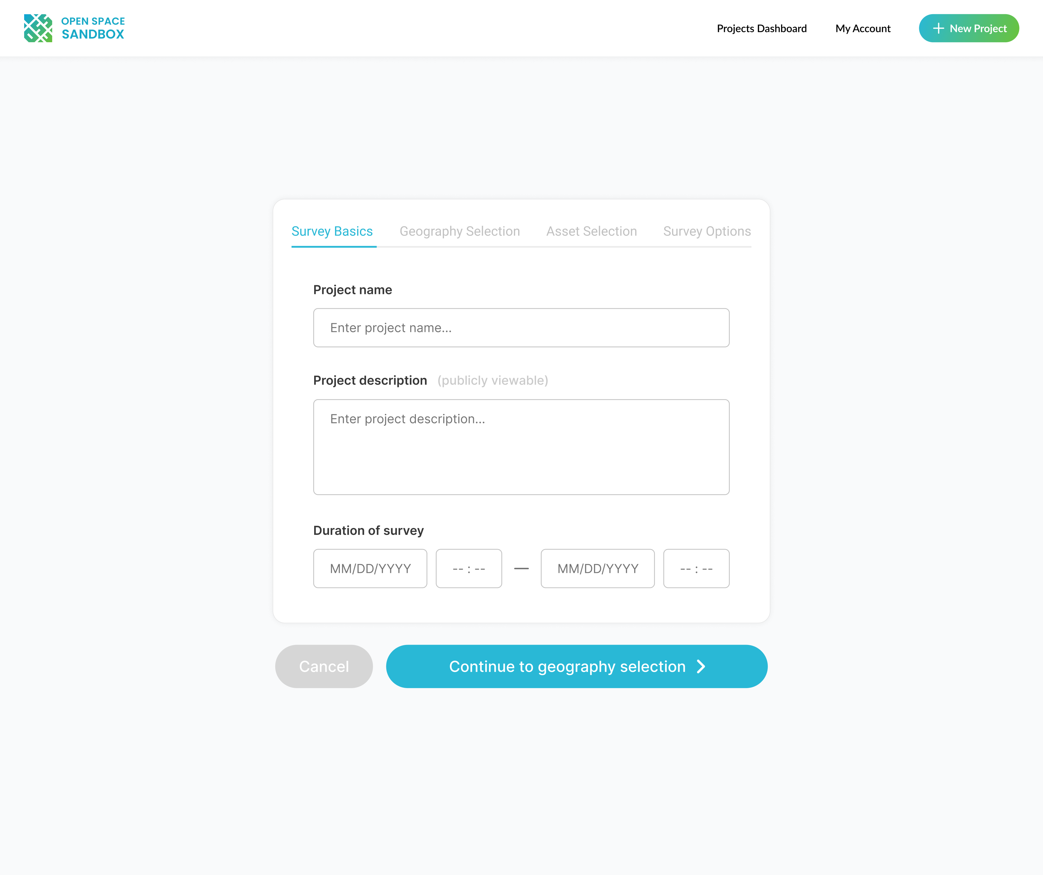
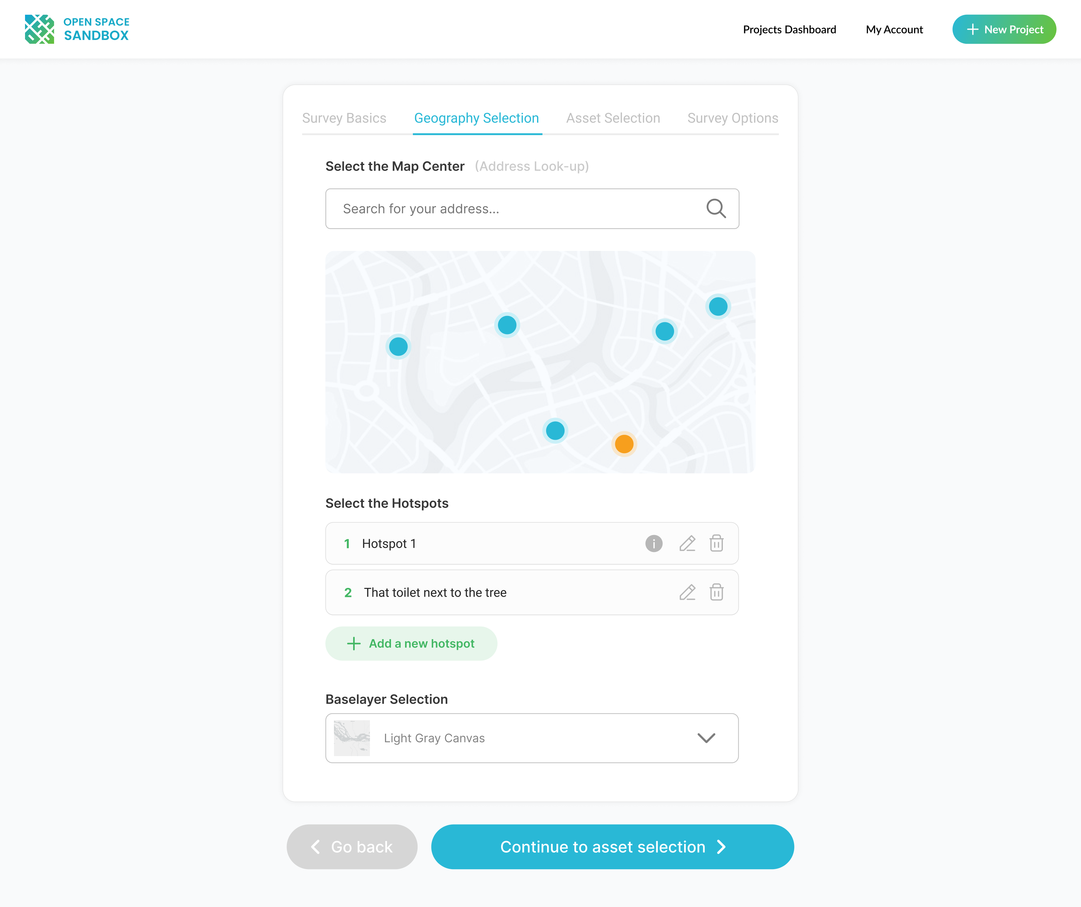
In the first stage of the new OSS process, the practitioner reviews the existing conditions maps and creates the high-level design outline.
OSS’s built in data analytics provide planners with a deep understanding of community demographics through census data, social infrastructure maps, and other relevant datasets. This tool allows designers to map out local needs and preferences in a way that guides them toward data-informed, impactful designs.


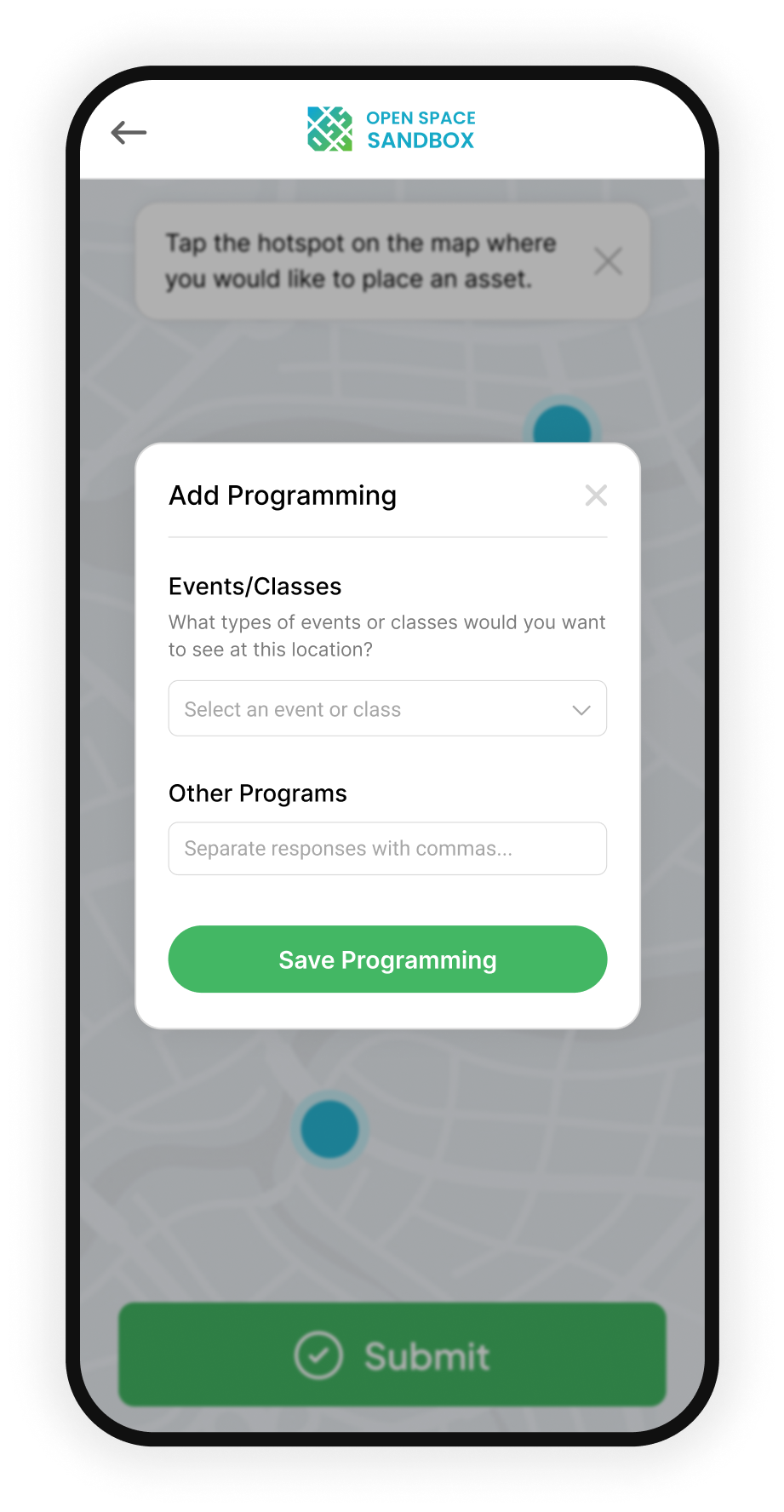
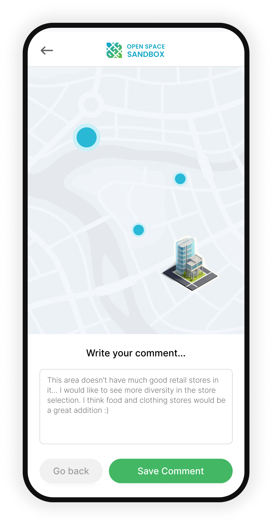
Community Design Consultation
In the second stage of the new OSS process, the community uses the tool's collaborative live-link to provide their design and programming ideas.
Empowering community members is central to OSS’s mission, and this feature allows residents to engage directly in the design process. Through an intuitive drag-and-drop interface, residents can express their vision for a space in a way that is accessible and impactful. This consultative approach ensures that the community’s voice shapes the final design, increasing public investment and satisfaction with the result.

Finalization & Analysis
In the third stage of the new OSS process, the practitioner finalizes the design using the community alignment score and inputting revenue data.
A sustainable urban space must balance community alignment with financial feasibility. OSS integrates analytics to assess how well designs meet community needs and their revenue potential. This dual approach enhances long-term viability, enabling spaces to thrive well beyond the initial launch.
Outcomes
Within the first 6 months of launch, using the MVP demo, we secured:
✦ A fellowship funded by the Knight Foundation for emerging city champions
✦ Grant funding for a pilot program in Philadelphia, PA
✦ Speaking engagements at Civic Tech Toronto to talk about our product vision